

 |
 |
 |
 |
|||
 |
||||||
|
|
||||||||||||||||||||||
 |
||||||||||||||||||||||
 |
||||||||||||||||||||||
 |
||||||||||||||||||||||
|
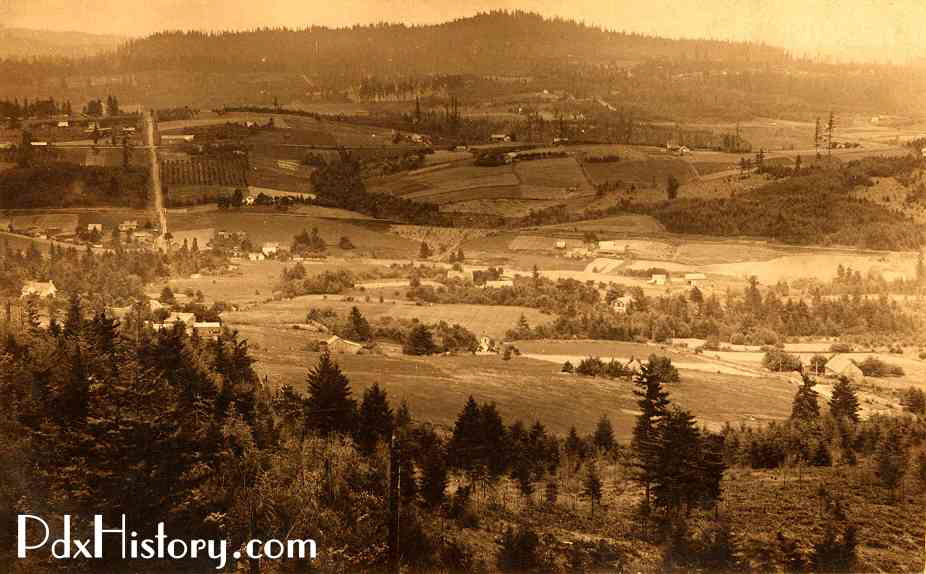
A view of the Tualatin Valley in Portland’s Southwest Hills in about 1912. |
|
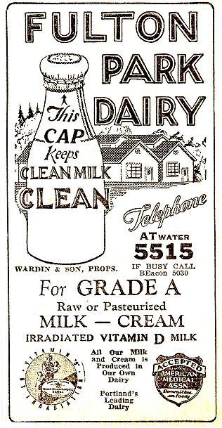
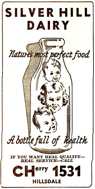
In 1851, John Slavin obtained a Donation Land Claim and built a cabin and barn at what is now Capitol Highway and Sunset Boulevard. Slavin had a quarry in the Hillsdale area and he built a road from South Portland along what is now Corbett Street up to what is now Hamilton Street. Slavin Road continued up to Hillsdale and it was later named Capitol Highway. It was extended to Tigard and beyond. All of the land in Burlingame, Capitol Hill, Fulton Park, Hillsdale and Multnomah was visible from Council Crest. Prior to 1888, the original land that made up these subdivisions was part of the Thomas F. Stephens donation land claim. The land was purchased from him in two separate transactions in 1858 and 1868. After Portland became connected to the Northern Pacific Railroad in 1883, Portland saw an influx of immigrants. German, Swiss and Italian immigrants began to settle in Portland’s Southwest Hills in what became known as Hillsdale and Multnomah. Many of them established dairies and vegetable farms. Beginning in the late 1880’s and continuing after the turn of the century, the rolling hillsides of southwest Portland between Hillsdale and Beaverton became dotted with dairies largely operated by Swiss immigrants. Portland’s gentle hills, with their abundance of lush pastureland, and its moderate climate are ideal conditions for raising milk cows, and they contributed to the success of the local dairy farmers and the milk companies. Most of these dairy farms had vanished by the end of the 20th century. |
 |
|||
 |
|||
|
Portland phone book ads from 1941. |
|||
|
|
Builder’s photo of one of the first Fulton Park cars ordered in 1889 from the Pullman Car Co. |
|
Electric streetcar service from downtown Portland to the Fulton Park area was inaugurated on New Year’s Day in 1890. A powerhouse and carbarn were constructed at the Fulton Park terminus. Several days later, a severe snowstorm descended on the city and when the water system at the powerhouse froze up, service was brought to a standstill. |
 |
|||||
|
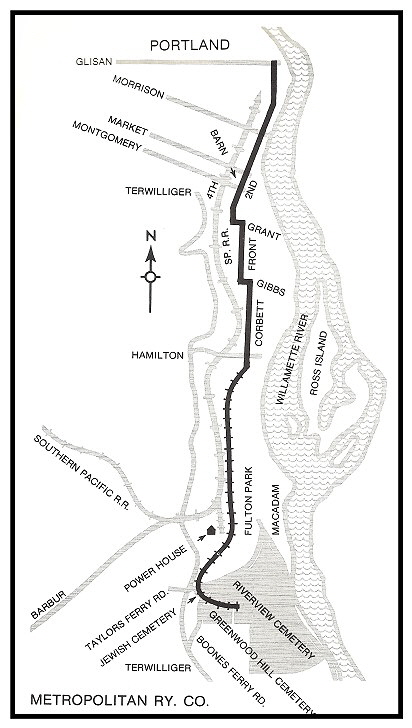
Map of the original Fulton Park branch of the Metropolitan Railway Co. |
|||||
|
After the first thaw, steep banks along the rural sections gave way, and disasters continued to plague the line. Finally, by late March, the line to Fulton Park was restored to service. By Memorial Day in 1891, the Fulton Park line was extended to the western edge of Riverview Cemetery, making the six-mile line from Second and Glisan to the cemetery the longest electric line in Oregon. Planned extensions to Lake Oswego and Oregon City never were constructed. Under new owners in 1900, the line was rebuilt as a narrow gauge line and it served until 1923 when it became part of the North-South line that operated until 1937. |
|||||
|
Interurban Rail Lines come to Fulton Park |
|
|
||||||||||||||||||||||
|
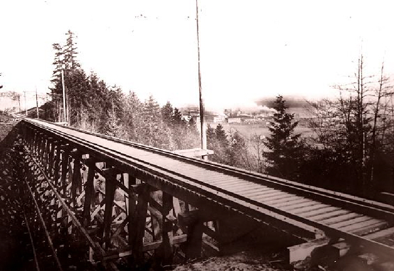
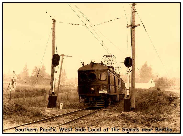
Interurban rail lines were built through Fulton Park beginning in 1908. The Oregon Electric Railway built a line through Fulton Park that went south from downtown Portland along what is now Interstate 5 and west to Garden Home where the line split. From there it went either west to Forest Grove or south to Salem. In 1912, the line was extended from Salem to Eugene. The Southern Pacific built a line that also went through Fulton Park. Steam trains operated there before the line was electrified in 1914. The Southern Pacific’s West Side Local cut through Portland’s West Hills along present-day Barbur Boulevard through Fulton Park and Burlingame to Bertha on their way to Beaverton, Forest Grove and points south. |
 |
||
|
Portland’s east side industrial district can be seen in the distance from the Southern Pacific’s Bertha trestle on the present-day site of Barbur Boulevard near Fulton Park. |
||
 |
|
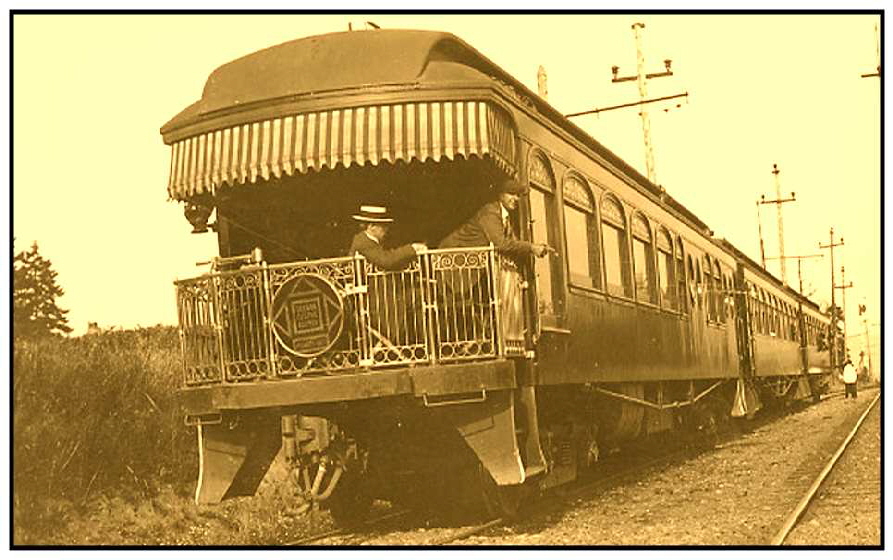
The Champoeg Car pulled up the rear on a three-car Oregon Electric train at Fulton Park in 1912. |
 |
|||||||
|
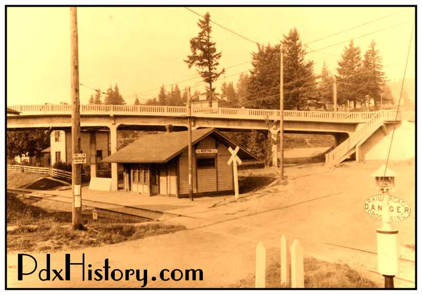
Bertha was the name assigned to the depot on the Southern Pacific Railway line on the southwest corner of present-day Hillsdale where the line enters the Tualatin Valley. It was named for Mrs. Bertha Koelher, wife of the manager of the Southern Pacific lines in Oregon. Prior to that time, it was known as Summit, the name given to the confluence of the Willamette and Tualatin drainage areas. Other depots in Oregon were also named Summit, so the name was changed to Bertha about 1890. Because Hillsboro was also on the Southern Pacific Line, the railroad wanted to avoid any confusion with Hillsdale and they refused to call it the Hillsdale stop. |
|||||||
 |
|||||||
|
A Red Electric train west of the Bertha Depot. |
|||||||
 |
|||||||
|
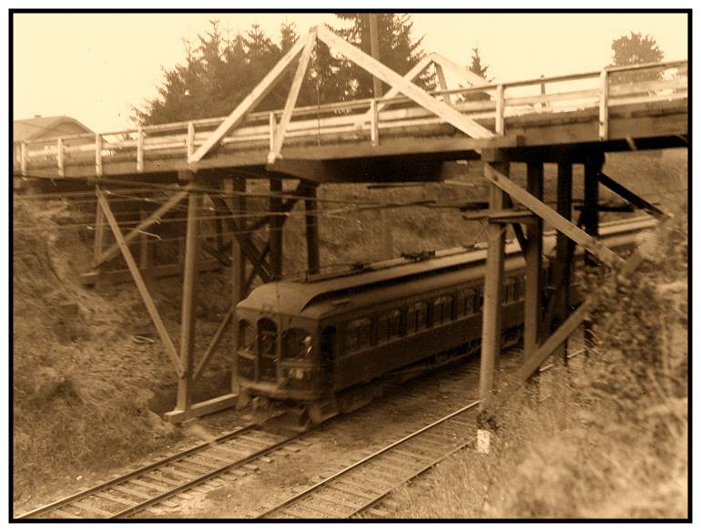
An Oregon Electric train passes under an overpass at 19th on what is now Multnomah Boulevard. |
|||||||
 |
|
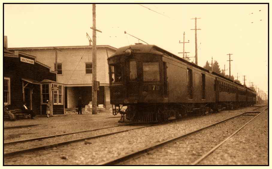
The town of Multnomah got its name from the Oregon Electric’s Multnomah Station which was built in 1907 at what is now 35th and Multnomah Boulevard. A post office was established in Multnomah on February 7, 1912. |
|
|
By the 1920’s Multnomah had become a bustling town in Portland’s Southwest Hills. |
|
|
By the 1940’s, Multnomah offered all the amenities of a modern suburb of Portland. |
|
Burlingame is the name of a street near Wilson High School and it first appeared on the Burlingame plat from 1910. The city in California that is named Burlingame may have inspired the name. The whole area south of Wilson High School and Capitol Highway to Barbur Boulevard and Riverview Cemetary on the east, Collins View on the south and Multnomah on the west was formed by taking land away from the Fulton Park District which was formed in 1888. The area that is now south of Interstate 5 was referred to as South Burlingame. Capitol Hill refers to a small hill in southwest Portland developed with residential view property and it was listed as a subdivision in 1907. The name may have originated because it was on the main highway to Salem, Oregon’s capitol. Capitol Hill School opened in 1913. Fulton Park refers to the original Fulton Park District which consisted of 411 acres and was formed on July 20, 1888 when Philip A. Marquam sold the land to the South West Portland Company for $150,000. It included the present-day South Burlingame neighborhood as well as an eight block corridor of land that follows Terwilliger Boulevard north from Interstate 5 to Capitol Highway. The long-closed Fulton Park Elementary School, which was built in 1914, is now the Fulton Park Community Center. Portland Parks and Recreation acquired the building and the property in 1958. Hillsdale, which is also the name of a street in Hillsdale, was the name given to the area north of Wilson High School and Burlingame and the name has been in use since pioneer days. The word “hill” is derived from the Anglo-Saxon and Norse regions of Europe. “Dale” means a small valley or dell. Distinguished early settlers included the Slavin and Dosch families, world-famous horticulturalist Dr. Cardwell, the well-known circus man Isaac Baird and the famous minstrel George H. Primrose, head of the Primrose Minstrels. |
|
Last updated 10-28-16 |
|
copyright © 2017 PdxHistory.com |